Published Friday, August 07, 2026 at 11:42 AM PT
Burbank · Friday, August 7, 2026 · 11:42 AM · 91°F, 41% humidity, wind 0 mph S (gusts 2), 29.44 inHg, UV 0, PM2.5 4
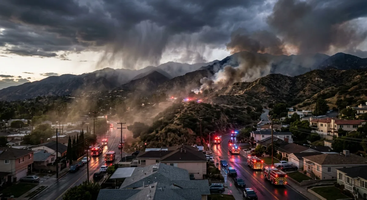
A wildfire is actively burning near homes and an elementary school in Santa Clarita as of late Friday morning. Authorities confirm the fire is spreading through the northern reaches of LA County, with structures in the immediate vicinity at risk. Exact evacuation zones are still being determined; Santa Clarita residents in the affected area should monitor local emergency alerts and be ready to leave on short notice. If you’re in the northern Santa Clarita foothills or near the fire’s line of advance, tune to local news, check LA County Emergency Management’s Nixle alerts, or call 1-800-996-4734 for real-time evacuation guidance. Schools and community centers in the area may activate as evacuation shelters — confirmation is still rolling in, so check ahead before heading to one.
What we know right now: the fire is moving through brush and dry fuel in Santa Clarita’s fringe areas. The school in its path means families with kids in that zone need to act fast — don’t wait for an official order if you feel threatened. Grab your go-bag (critical documents, medications, irreplaceables), grab your people and pets, and head south toward safer ground. If you’re evacuating, use surface streets, not freeways, which will jam if everyone bails at once. I-5 toward LA proper is your main southbound artery; stick to local knowledge if you know alternate routes.
Calfire is responding, but August in LA County means every asset is already stretched thin. Expect slower-than-ideal response times and mutual aid from regional departments. The forecast calls for hot, dry conditions through the weekend — winds aren’t critical factors right now, but that can flip fast. Check the National Weather Service for any fire-weather warnings or red-flag alerts that might compound the situation.
Here’s the brutal truth nobody wants to hear: Santa Clarita’s northern foothills are exactly where these fires like to start and move. The vegetation there is dense, dry, and prepped to burn. The fire finding an elementary school nearby is unfortunately not shocking — it’s just geography and probability catching up. Every year we get tighter, drier, hotter, and the fires get meaner. This is what that looks like in the real world at 11 a.m. on a Friday in August.
If you’re not directly threatened but you live in LA County, this is a heads-up: know your evacuation route now, not when the alert comes. Have a bag ready. Fill your car’s gas tank when it hits three-quarters full in fire season — stations run dry when evacuations begin. And for the love of every overworked fire dispatcher in the county, do not go rubbernecking toward the fire to take pictures. I’ve watched networks broadcast helicopter footage of civilian cars creeping toward active wildfire zones. You’re not helping; you’re blocking the evacuation route for people who live there.
Pasadena’s fire crews are currently staged for mutual aid assistance, which means they’re standing by to deploy. That’s actually a good sign — it means resource-planning is happening. But it also means this fire isn’t small enough to ignore.
Updates will come fast from here. Stick with KTLA, ABC7, or local Pasadena/Santa Clarita news feeds for real-time changes. Download the LA County Emergency alerts app if you haven’t. And if you’re in the evacuation zone and reading this: don’t wait. Go now.